For anyone that knows me, you would know that I am never shy of a challenge. The prospect of spending 14 days in the wild south-west sounded like a challenge that I was up for, both mentally and physically. I was probably in as good a shape as I have been since the days of my distance running phase. Although the longest walk I had completed previously was a 6 day walk, spending each night in a hut (I know its a little hard to believe), I thought I was up for this. The challenge was a full traverse of the Western and Eastern Arthur Ranges in the South-West corner of Tasmania. This rugged quartzite range is exposed to the worst of Tasmania's weather, taking hits from the Roaring Forties from the west, as well as the cold chills that drift north from the Antarctic waters of the Southern Ocean. It was highly likely that in a two week period, I was going to see some of this wild weather that the Arthur Range is renowned for. This is my day by day account of my trip.
The Western Arthur Range (November 9-16, 2011)
Day 1 (Wednesday)
Fresh out of my final university exam the previous day, I knew today was going to be a long day, and possibly physically the hardest of my planned trip. I knew I had to lug 22kg up the steep Moraine A.
I set off from Hobart at 3:30am, half an hour later than planned. I had not slept much that night, exciting in anticipation. I fumbled around in the dark, trying to find my tent poles, which were no where to be seen. It wasn't looking like a good start. I eventually found them in the back yard, exactly where I had left them the day before. I finished packing my bag and I was off. It was a pleasant drive out to Scott's Peak, with a bit of mist about, but it was mostly dry, which was a good sign.
Arriving at Scott's Peak just before 6am, it was misty, but warm - around 15 degrees. The mist had me worried that I was in for a wet, miserable day. Despite my pessimism, I trekked off down the track. I seemed to be making far better progress down the Port Davey Track than I had remembered. On my first trip in here it had taken me almost 5 hours to reach Junction Creek. I was there in half the time. The creek was barely a trickle, not even ankle deep. I scrubbed down my boots and had a snack stop before the big climb.
After another 40 minutes later I was at the foot of Moraine A. I had barely been able to see the range due to the thick mist, despite the fact that I was standing right underneath it. I started climbing, and I was quickly above the mist. I tackled the moraine in short sharp bursts, trying to gain 100m at a time where I could. I found that regular breaks helped me to keep a steady pace.
 |
| The mist over the Arthur Plains, Mt Anne in the distance |
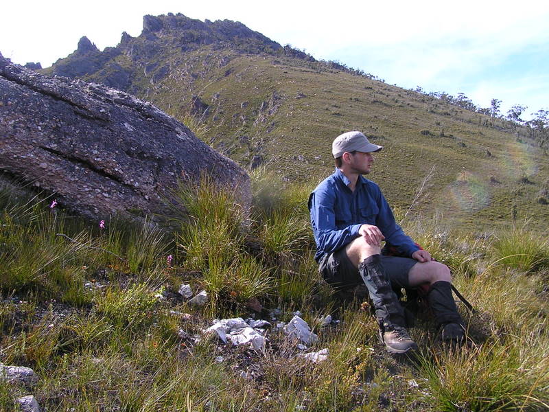
The sun was out, and the further up I climbed, the more I was struggling. I finally hit the summit of Mt Hesperus at 12pm, much faster than my first attempt. I was impressed by reaching this point in 6 hours. I kept moving, skipping past Capella Crags and Mt Hayes as I had already climbed these on my first trip in here. I found the descent off Mt Hayes a bit of a struggle, my body was starting to cramp up, and it was getting quite windy. I pushed on and hit the saddle below Procyon Peak. I dropped my pack and ran off to bag the summit. I followed some well worn pads around some buttresses, then up through the boulders near the summit. I had a decent break up on the summit, with views west towards Mt Hayes, south the the Norolds and Port Davey, and east to Mt Sirius and Orion, which were in my plans for today. I returned to my pack, and began to head down to Square Lake. It took 20 minutes from the saddle to lake. It was now 4pm, and knowing that with side trips to Mt Orion and Mt Sirius, my tired body was not going to reach Lake Oberon before nightfall. I decided to set up camp at Square Lake in a little grassy patch to the south of the lake.
 |
| Square Lake and Procyon Peak |
The sun was shining when I arrived, and I was keen for a swim, so I stripped off and jumped in the lake. This lasted about 30 seconds. It was freezing to say the least. I got the tent set up and dinner cooked, and jumped into bed. A 10 hour day had me wrecked. At about 6pm I woke to light drizzle, but still light. Then the heavens opened. A spectacular thunderstorm ripped across the range, luckily for me it only lasted a couple of hours. It was a nice way to end the day, despite the heavy rain. I was nice and dry in my tent, and the patter of the rain was somewhat soothing. I drifted into a fairly deep sleep, exhausted after a long day.
Day 2 (Thursday)
Today didn't start well. It was raining pretty constantly, and I was resigned to having a tent day, after all I was still pretty tired from the previous day. The sun was trying to break through, and the wind was blowing a gale. It came to 9am and I decided to bite the bullet and pack up and move. It was only going to be a short day carrying the pack. It was about 9:30am when I left the campsite. The climb up to the Orion-Sirius saddle was not as bad as I had expected. From Square Lake the climb looked imposing, but I made good time up there. I dropped the pack and went for a quick run up Mt Sirius, following a fairly good pad most of the way. I returned to my pack and ambled along the track for 5 minutes until I reached the Mt Orion track turn off. I wandered up the track, and then lost it, bashing my way through low scrub and boulders. I reached the saddle between its two summits, and found the track again. I followed the cairns until the block below the summit. The cairns seemed to head further west and come up the western side of the summit. I didn't see the need to use the track, the boulders seemed easy enough to scramble straight up. They were a little steep and slippery, but there were no major dramas. After a short break on top, I decided to follow the cairns back the to the saddle. It took much longer than the direct route that I had used. At one point I found myself squeezing through a narrow crevasse to negotiate a large block that was obstructing my path. I picked up my pack and started to head to Lake Oberon where I would spend the night. I had heard many stories about the descent into Lake Oberon.
 |
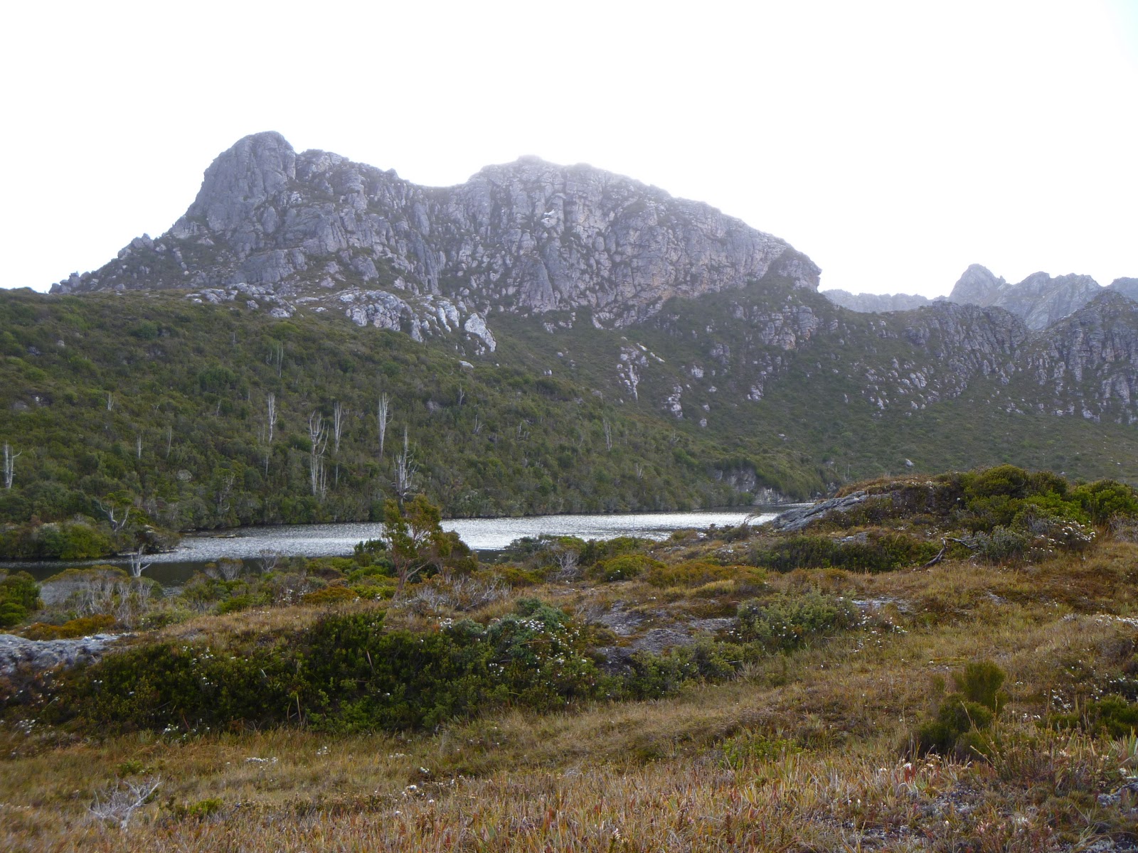
| Lake Oberon |
It is reputable for its steep scramble down the gully, and I had heard that if this was found to be difficult then you should not continue through the range. I started wandering down, wondering what all the fuss was about. The track was quite slippery, but at no point was it extremely steep or dangerous. Then after a few minutes of descending, I found the section that people were talking about. I can see how groups could have trouble with it, but even in its slippery, wet state, I had no issues scrambling down. The traverse across the ridge top and down into the lake was a little monotonous, It was raining and windy, and I was keen to just jump into the tent. To my surprise it was only 1pm when I arrived at the campsite. The designated platforms had to be the worst I had ever camped on. There were very few nails in the platforms to hook the tent into to achieve a good pitch, and the track to the toilet and water sources was a mess, mostly underwater, with bog all around it from where people have been avoiding the water. I set up camp and had some lunch, and decided to make the following day a bit shorter by going for a run out to Mt Pegasus and its southern neighbor.
 |
| Square Lake and Mt Sirius |
The walk up Mt Pegasus would give me an idea of what I was in for the next day, I had heard of a few tricky bits going up there. I made really good time heading up, I found a couple of slippery sections, but had no real issues. Close to the top there is a boulder squeeze, which was great fun with just the day pack on, but I knew this was going to be tricky with the full pack. I reached the summit of Mt Pegasus in 45 minutes. It was fairly clear up on top, but extremely windy. I wondered if the wind was ever going to settle down. I headed off the summit and bashed down towards the open ridge that lead out to Pegasus South. The scrub was low, and I found pads in places. Once on the open ridge it was easy, with a few small buttresses to sidle, but as long as I kept to the western flanks I was fine. After a short scramble I was on the summit. It was so windy I could barely stand. I snapped a couple of quick photos and headed back to the main track. On the way back I discovered a clear cut track from the beginning of the ridge back up to the main track. It sticks very close to the western side of the buttress that must negotiated. I eventually hit the main track again and headed back to Lake Oberon. There were a couple of spots where I lost the track, but some airy scrambles saw me back on it again. I was back at the campsite by 3:30pm, very surprised, since Chapman's guide to the Western Arthur's suggested it takes 2 hours to do the trip to Pegasus South from the summit of Mt Pegasus. To do both from Lake Oberon in 2.5 hours seemed to be a good achievement.
I cooked up a big dinner and had a cup of coffee, the rain threatening, but with the wind as strong as it was, it was never going to stay around for long. Every time it rained the wind would push the storm on and it would be clear again. I was hoping for a good nights sleep, knowing that the next 2 days of the trip would be the hardest.
Day 3 (Friday)
I didn't sleep well at all that night. It rained constantly, and due to the horrible tent platforms, I had to wake up every 30 minutes or so to push off all the water that was pooling on the bottom end of my tent. I now wish I had a free standing tent, I would have slept well in one of those. It was still pouring when I woke up, and I had very little energy. I decided this was definitely a tent day. By late morning the weather had cleared and it was a beautiful day. I should have been out walking, but it was going on too late now. I got a good rest and was primed for the next two hard days ahead.
Day 4 (Saturday)
I woke up bright and early for the walk to High Moor. I had had a pretty dry night, I was glad to have a dry tent to pack up. The climb up Mt Pegasus was relatively event free, only having to take off the pack in the boulder squeeze. The descent off Mt Pegasus was quite steep, but no major dramas. Before I knew it I was almost at the top of Mt Capricorn. The ridge up to the summit seemed effortless. It was 11am when I reached the summit, I'd been walking for about 3 hours. I had a quick snack and off I went. The descent off Mt Capricorn is unreal. I had heard that it is becoming impassable, but the muddy slopes were quite dry and I had a good track to follow down. The track heads almost straight down, a series of muddy steps showing the way. I reached the bottom and looked back. It looked impossible. I wouldn't like to have to walk up it thats for sure. I continued on and left my pack on the high point of a small sidle of a knoll. I climbed up the knoll and found a pad that lead down the other side. The pad would lead to the saddle of the knoll and Dorado Peak. It dropped off the knoll steeply, but the track was easy to follow. From the saddle it was very quick to the summit. The sun was out and it wasn't too windy.
 |
| High Moor and Mt Columba from Dorado Peak |
I quickly retraced back to my pack and was ready to tackle the slopes of Mt Columba. This didn't take very long, and before I knew it I was walking down duckboards to High Moor. This was probably the best campsite on the range, despite its apparent exposure. I had only just set up the tent when I saw a figure walking down the hill. He stopped in and said hello. I was relieved to have finally seen someone else on my trip. He had walked from Lake Cygnus that day. He was considering continuing on to Haven Lake, but he decided against it. It was only about 3pm when he arrived. His plan was to get off the range the following day. Only two nights on the range seemed a little strange to me. Why not spend some quality time embracing the remoteness and wildness of the south-west? I couldn't understand it. He set his tent, and I had a cup of coffee and then shot off up Mt Columba. I had some good views up here, and I was hoping to make it back up for sunset since it was clear. I got back and had a short nap before I cooked some dinner. The sun was setting, but it was not a spectacular sunset like I had hoped. I decided to call it a day, with a big day to come.
 |
| Evening at High Moor. Dorado Peak in the background |
Today was the first day I had started to doubt my 14 day plan. I still had until Thursday before my Eastern Arthur's plan became a no-go. The mental challenge of getting up and moving was starting to get to me. Luckily for the next morning I had someone there to wake me up and give me a kick along.
Day 5 (Sunday)
When I woke, the conditions were almost perfect. There were almost no clouds in the sky and the sun was out. And as an added bonus, my tent was dry from the clear night. Today was the last hard day of the Western Arthur's, the Beggary Bumps. Breakfast was eaten and we were on the track by 8am. It didn't take long before our first obstacle was reached. I had a struggle on a little ledge that required sidling across. The weight of my pack made it a little difficult. After getting down the ledge we headed to the Tilted Chasm. The Tilted Chasm follows down the side of a large buttress, with a scree-like slope to follow down.
 |
| The Tilted Chasm |
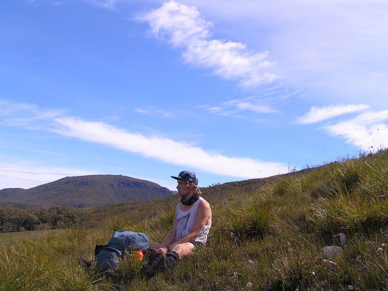
It was loose and slippery so we took our time to make sure we got down safely. We were quickly at the next major landmark on the Beggaries. We reached The Dragon. This was where I had planned to leave my friend and tackle Mt Shaula. I wandered up to the summit of The Dragon to try to find a route down, but I could not find one. Then an almighty hail storm hit. I decided it was best to head back to the track, where to my surprise I found my campsite companion wandering aimlessly, having lost the track. After a bit of searching I found the track and we were off again. We dropped down a gully and then the track turned to head back uphill again. It was still hailing quite heavily. The track seemed to go up an awful long way, and it didn't feel quite right, despite being on a well worn track. We got to a high point only to realize that we were heading back up the other side of The Dragon. We were on the wrong ridge line. I think I just found the way out to Mt Shaula. Due to the persistent hail I decided to leave Shaula for a day trip later in the summer, where I hope to summit from the plains below. We headed back down and found the track and followed it without too many issues to Mt Taurus and Haven Lake. This was my stop for the day. It was 1pm when we reached the lake. My friend continued on, he was hoping to reach Cracroft Crossing by nightfall. He still had quite a way to go. I could hear him cooee from the top of the ridge above the lake as I was setting up my tent. After getting the tent set up, I grabbed a few bits and pieces and threw them in the day pack and headed off for Mt Aldebaran. The guidebook said it was going to take 2-3 hours. There was a reasonable pad out most of the way, at least where it was needed. The views from the summit were amazing. I could see quite a distance, with good views of the Eastern Arthur's, West Portal, as well as the range I had just walked across. The Beggary Bumps looked insignificant, and Mt Sirius was still an imposing figure.
 |
| Western Arthur's from Mt Aldebaran |
 |
| Wind blown tree above Haven Lake |
I had decided by this point not to continue across the Eastern Arthur's as my body was hurting, I had hurt my shoulder somewhere in the Beggaries. I got on my phone and let a few people know my revised plan. I felt that I had still made a significant achievement by completing all but one peak in the range so far. Having already been through the Eastern Arthur's before, it was a pretty easy decision to make anyway. I returned to the campsite, it took me well less than 2 hours for the return trip to Mt Aldebaran. Again I had beaten Chapman's times. I must be getting fitter I thought. The evening was amazing at Haven Lake. The sun was reflecting beautifully off the lake, and the wind had died down. I cooked up dinner and headed off to sleep, ready for a relatively easy day tomorrow.
 |
| Sun shining on Haven Lake and Mt Taurus |
Day 6 (Monday)
Today didn't start well. It was raining heavily, and the thought of packing up my tent wasn't a welcome one. I decided to wait it out for a while to see if the front passed. About half an hour later it passed and I packed up and got moving. Just as I started to move, the rain came down again. I was aiming to camp at either Lake Vesta or Juno tonight, just under Mt Scorpio. I headed up across the ridge to the descent to Lake Sirona, and then up to Mt Sirius. It was quite windy on the ridge top. After getting a few photos up on Mt Scorpio I proceeded to descend down the Kappa Moraine track. I turned off the track to head down to the lakes. Both the Lake Vesta and Juno campsites were waterlogged, so I had no choice but to continue to Promontory Lake. The walk around the lake shore was tedious to say the least. It was boggy, and it was raining. The designated camp site here was also a muddy quagmire, so I was forced to camp on an exposed grassy ridge. It was a good spot, except for the howling gales that were blowing in from the west. It was 4:30pm by the time I had my tent set up. Not realizing how late it had got, I decided that I better go for a quick run up Carina Peak. I found a pad and cairned track to follow up. There is only 3 metres in height difference between its twin summits, so I climbed both to be sure I had climbed it. I started to descend, and it started to snow. Now I'd had it all. I somehow lost the track I came up, so I just bashed down, descending some small cliffs with the assistance of scoparia branches.
 |
| View from my tent at Promontory Lake (Carina Peak) |
I made it back to camp and ate some food and curled up to read a book for a while before sleeping. Only 2 days left and I would be home.
Day 7 (Tuesday)
The wind didn't relent at all overnight. I slept reasonably well still. I got up early ready to tackle West Portal as a day trip. I was expecting to spend somewhere between 8-10 hours to get out and back. I made my way up the ridge to The Sculptor and then descended into the saddle above Lake Venus. I picked up the track and made quick progress up The Phoenix. I was up on the summit of The Phoenix after half an hour. It was quite clear, but still windy. I could see what I had to negotiate to get to West Portal. There were two major bumps to climb over before a steady climb to the top. I headed down off The Phoenix and headed to the first bump. I was up in no time, and then the track flattened out for a while. I reached the second bump, but the track sidled around the southern side, meaning less climbing for me. After 1.5 hours I was on the final ridge to the summit. It took around 45 minutes from here to reach the top. I climbed the first summit, which is an easy scramble up boulders. It is not the highest point, but in my opinion, had the best views. I could see the entire Western Arthur's, and the Eastern Arthur's looked very close. Federation Peak looked very attractive from here. I dropped off this summit in search of a route up to the high point. I had heard that it was an airy scramble to the top. I found a gully to scramble up. It was a little airy, but nothing too difficult. I had a snack up on top and took some photos, then tried to find a better way down. I found a gully that was far easier than the way I came up. It wasn't airy at all.
 |
| Federation Peak and the Eastern Arthur's |
 |
| The Western Arthur's from West Portal |
I continued to retrace my steps back to the track. The weather started to close in as I was climbing back up The Phoenix. I still had a trip out to Mt Canopus to do before I could go back to the tent. I left the track at the bottom of The Phoenix and sidled around The Sculptor to the ridge that leads to Mt Canopus. I made the mistake of trying to gain height too early and found myself having to drop back down a few times. It was relatively easy walking, the wind making it harder. I reached the top and the rain and hail started to come down. I thought I better get back to the tent as quick as I could.
 |
| Looking at Promontory Lake from Mt Canopus |
By the time I got back to the camp it was pouring and very cold. I stripped off quickly and jumped into the tent to warm up. It had taken 7 hours to walk to West Portal and Mt Canopus. Much faster than I anticipated. It was only about 4pm, so being my last night of the trip, I finished reading my book, Wolf of the Plains by Conn Iggulden. I recommend it if you enjoy historical fiction. By 8pm I was asleep, resting up for the tedious walk out across the Arthur Plains.
Day 8 (Wednesday)
I got up early and packed up, heading for the Kappa Moraine track. It was sunny in the morning which was a nice change from the last couple of days. I passed Lake Juno and Vesta and headed down the track. I planned to take the shortcut off the moraine to the McKay's Track. I left the track and headed down through the button grass. I must have picked a route slightly too far down the track. I hit a forest, and could see a spot on the other side that I set a bearing for. Entering the forest I encountered some thick scrub, but after a bit of pushing, I entered an open rain forest. It was quite pleasant walking. I followed a creek down, then I could see the button grass clearing. I pushed through the scrub to the clearing, where there was a large rock that I climbed to pick out the best route down to Seven Mile Creek. It was open walking down to the creek. I picked a spot that had been burnt out by a bush fire. It had a little bit of scrub, but was fairly easy to negotiate. I crossed over the creek, about thigh deep, and headed up to the button grass plains until I hit the McKay's Track. I don't think the shortcut saved me a lot of time, but it cut off about 5km of walking. I plodded along the muddy track until Wullyawa Creek. I stopped for a break and I decided to put some music on my iPhone to hopefully make the time pass a bit quicker. It was quite warm down on the plains. I made much better progress walking with the music. I was aiming to cover about 1 kilometre every 15-20 minutes. I think I was achieving this. I ran into a guy at Two Mile Creek who was planning to go up Kappa Moraine that day, it was about 1pm already. He was going to head to West Portal and then up into the Eastern Arthur's. It seemed like a lot of effort to go to, but good on him I guess. I made it to Junction Creek about an hour later. I headed back down the Port Davey Track, heading towards the car park. It was getting cloudy, and rain was threatening. It started to drizzle just as I was entering the forest half an hour from the car park. I was back at the car at about 5pm, taking about 3 hours from Junction Creek. I was glad to get out of my wet, muddy clothes and into a clean set, and glad to be at the comfort of my car. I drove on home, getting home at about 8pm. I was exhausted, and slept very well that night.
This was by far the most rewarding trip I had ever been on. I learnt a lot about myself, and pushed some mental and physical boundaries. I recommend that anyone who is fit and able visits this range, at least as far as Lake Oberon. I would be very happy to revisit this part of the state, hopefully in better weather next time, although I think I had it pretty good up there!