So after beginning to write up my latest trip reports, I have decided to write up a few older trips that I have done. Over the coming months I hope to add many more to this page. I will begin with a walk that I did with friends Nick and Simon last December, the destination, The Thumbs.
 |
| Lake Gordon |
After hearing of the feats of other walkers completing a walk to The Thumbs via Clear Hill in 10.5 hours, the challenge had been set. This was a walk that Nick and I had been wanting to do for a while, so we picked our day and set off. And what a day we got! We set off from Hobart at around 6am, and we arrived after finding the start of the track around 2 hours later. The track leads only as far as the summit of Clear Hill. The start of the track is marked by a few tapes, but is rather inconspicuous. It took us quite some time to find. If you reach a high point on Clear Hill Road, you have gone too far. The road begins to head back down to the shores of Lake Gordon, with Wings Lookout - worthy of a visit in its own right - on the left. We got all of our gear on, and it was quite cool to begin with, but the skies were clear, and it was now that we knew that we had picked a perfect day.
 |
| Morning light on Clear Hill |
The track initially heads steeply through a mixture of bauera and tea tree, but quickly opened out to a gentle gradient, surrounded mostly by button grass and large conglomerate boulders. As the landscape opened out before us, the first opportunities for some amazing photos was upon us. After a few quick snaps we were on our way again. The track heads uphill using a series of rocky slabs, then sidles a false summit, before reaching a small boulder field that leads to a trig point at the summit. After about an hour we had reached this point. Clear Hill itself makes for a beautiful short day walk.
 |
| Mt Anne from Clear Hill |
 |
| The open slopes on Clear Hill |
 |
| Simon hugging the trig point |
 |
| The views were amazing! |
 |
| Looking out over Lake Gordon |
 |
| Summit Snaps |
 |
| Nick and I on Clear Hill |
From the top of Clear Hill, we proceeded to make our way down to one of the many open leads down to the Clear Hill Plains - a sparse open field of button grass, and more button grass. It didn't take us long before Nick had lead us straight into a tree filled gully, that proved to be a little tougher than expected, but it was the fastest feasible way to reach the spur that we were aiming for. After many tangles with tree branches, jumping between boulders, and pushing though bauera, we had reached our open lead. The slopes of Clear Hill had been burnt some years before, and regrowth is still low. This made walking very easy, although the temperature was beginning to rise. The nice cool breeze that started our day was completely gone, instead a nice warm northerly was blowing our way. After 30 minutes or so, we had dropped almost 600 metres to the plains from the summit.
 |
I think we need to go down there!
|
 |
| Looking for a way down. |
 |
| One of many scoparia filled gullies |
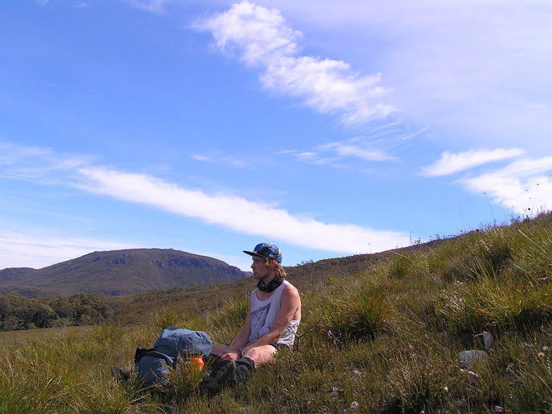
We crossed the plains three abreast, doing our part for minimal impact walking. The plains stretch for several kilometres, bordered by the Gordon Gorge to the north, and the abandoned osmiridium mining town of Adamsfield. In the 1930's, Adamsfield was a booming town, although all that remains now is a few old huts. As we continued to cross the plains, the heat continued to soar. After another hour we had reached a point of ascent, choosing the most open spur up the slopes of The Thumbs. There were many options to choose from, but we took the most open lead, furthest to the north. It would take us straight to the summit ridge line.
 |
| Descending into the plains |
 |
| Having a well earned rest |
 |
| Nick taking a break |
 |
| The Stepped Hills |
 |
| The Stepped Hills and Gordon Gorge, on the slopes of The Thumbs |
 |
| Ascending a gully near the summit |
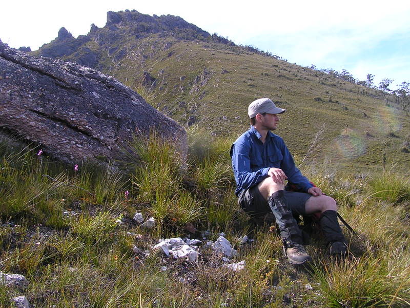
As we began to climb, Nick had found an extra burst of energy and began racing ahead, while I was stuck in the middle, Simon lagging behind. It was on the lower slopes that I stumbled across our first snake for the day, a little baby tiger. I didn't dare mention it as Simon, a Kiwi, would quite probably packed up and walked home at that point. After several breaks on the way up, I had caught up to Nick, resting on a large outcrop with an amazing view of the Gordon Gorge, and the Stepped Hills further to the north. We waited here for Simon, but after 20 minutes of waiting, he was nowhere to be seen. We decided to go looking for him, and it turned out that he had traversed on the southern side of the buttress that we had gone around, and he was sitting in a prime location, about 60 metres higher in elevation, trying to find us. From here, some large boulders had to be negotiated before we reached the final ridge. We had been climbing for some 70 minutes by now.
 |
| Our rest stop |
 |
| Clear Hill, almost at the top! |
We continued up the boulders, then encountered our first real patch of scrub, a valley of knee-waist high scoparia. This was easily negotiated, and after a further 30 minutes, we had reached a small plateau, where we could see the summit spire not too far away. The ridge is fairly open, but a few places required some rock hopping. The heat was sweltering by now, easily reaching above the 30 degree mark, with a warm breeze blowing. After 20 minutes of hopping along the ridge, Nick and I had reached the sloping conglomerate slab that is the summit. The extremities of the summit were covered in a dry green moss, but climbing was easy. Simon was behind taking some photos, but joined us on the summit shortly after, followed by many shouts from the top. After about 4 hours and 45 minutes, we had reached the top.
 |
| The Denison Range |
 |
| Tim Shea and The Needles |
 |
| Mt Field West |
 |
| The southern ridge of The Thumbs |
Now we had to turn around and go the whole way back!!
 |
| Two figures on the summit |
But not before we had some well earned lunch.
After a lengthy break up on top to regain some energy, we started to head back down. Initially we moved quickly, but as we kept moving, we realised how sapped our bodies were becoming, and that we needed to find water soon. Unfortunately there was not a lot to be found anywhere near the summit. We would have to wait until we reached the plains. As we reached the point where Simon had been waiting for us a few hours earlier, we all lay down, exhausted, but still a long way from home. The next part of the descent passed quickly as we pushed for the nearest creek. After about 80 minutes, we had reached a creek, just past the base of the spur. We lapped up precious water and filled our bottles, and had a well deserved rest.
 |
| Descending off the summit |
 |
| Large rock formations |
As we crossed the plains we kept an ear out for a second party, who we knew were heading in, with the intention of camping near the Gordon Gorge. We didn't hear or see them, but we must have only just missed them.
 |
| Almost there - Clear Hill |
It took less than an hour to cross the plains for the second time, the daunting slopes of Clear Hill now directly in front of us. At only 4 metres lower in elevation, the climb back up was going to be a hard slog. After crossing the hot plains, we were again exhausted, Simon was especially beginning to feel the effects of the heat. I can best describe the heat on the plains as a giant hotplate, or perhaps a sauna - although it was not like the German sauna we have all been seeking!
 |
| Nick getting some much needed water |
We picked a different lead to ascend Clear Hill. The spur that we aimed to climb was mostly open, and used some large slabs or rock to gain height quickly. The spur lead just to the south of the summit. We had to cross a few small gullies, one containing a welcoming creek, in order to reach our final lead. It took us almost two hours to climb to the top, although it felt much faster than this. We reached a point towards the top and beginning to become concerned with finding the track again. Our brains certainly weren't at full operating capacity after more than 9 hours of walking. We waited for Simon at this point, while we were still searching for sign of a track. Simon arrived and I decided to jump down off the boulder that we were all sitting on, and to my surprise, I landed on the track. It had been no more than 15 metres away from us all that time! From here we continued on down the track, finding some interesting rock features, one being a giant overhanging bivy cave. We reached the car at about 7pm, after setting out some 10 hours earlier. We had achieved our goal, and in good time too! We stumbled across the car of the other party parked behind us, with a banana peel on my bonnet proof that they were up to no good. We drove back to Hobart very tired, but very satisfied of our days work.
 |
| One last look back at our achievement. The Thumbs |
To this day The Thumbs is up there with the best walks I have ever been on. I would love to do it again, perhaps from a different point, and spend some time exploring the area around Adamsfield. Attempting The Thumbs via Clear Hill is a very big undertaking and I suggest that is may be better enjoyed as an overnight trip, or if you do decide to attempt as a day walk, allow yourself a minimum of 10 hours, but ideally about 12 hours. Most of all, be prepared for everything. Carry plenty of water and food, and a shelter, even if you are attempting a day walk.
Thanks to Simon for sharing some of his photos with me.